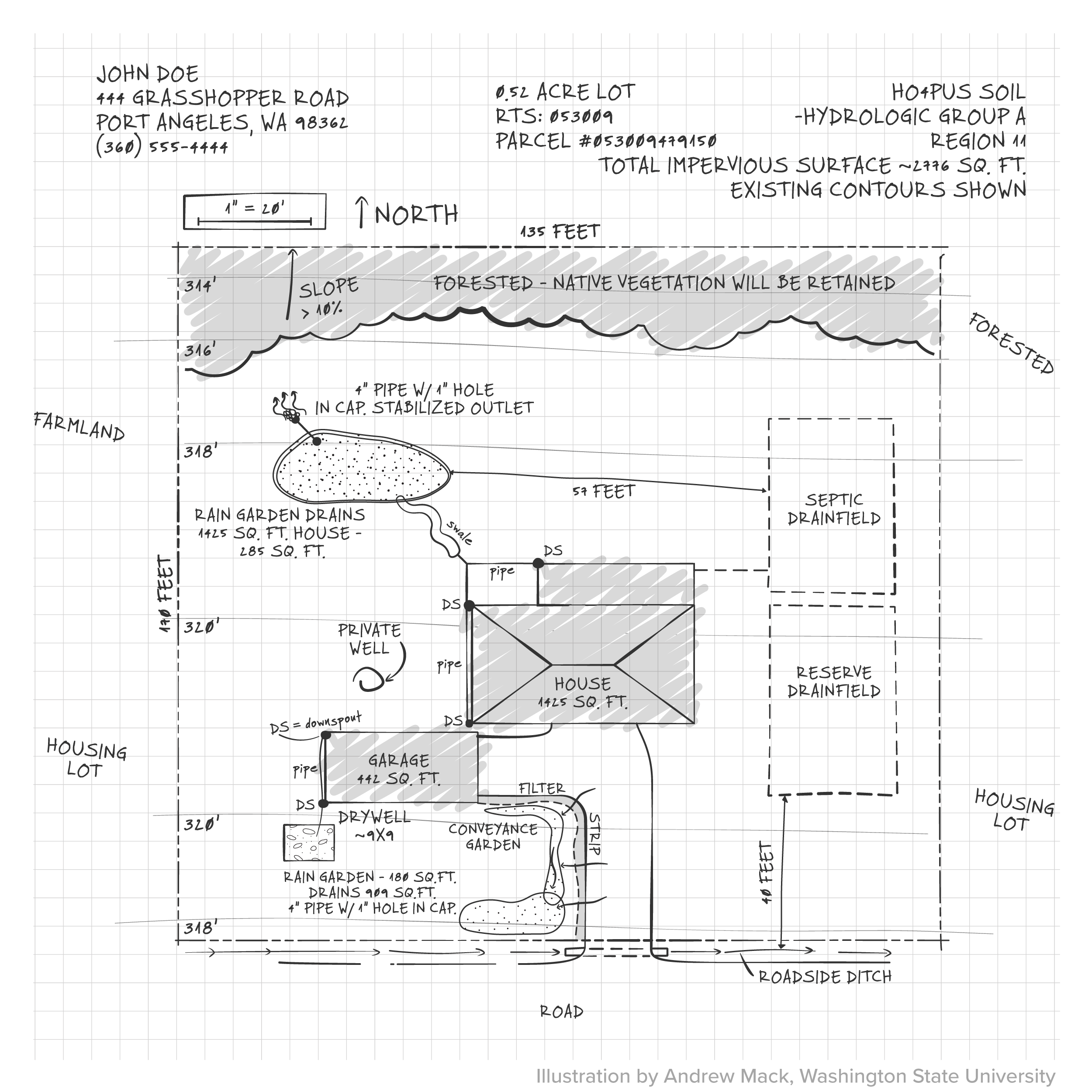
Creating a Site Map
A site drainage map is a simple diagram that shows how water flows on your parcel of land. It’s the first step in solving drainage issues on your site and helps you determine the best options for managing stormwater.
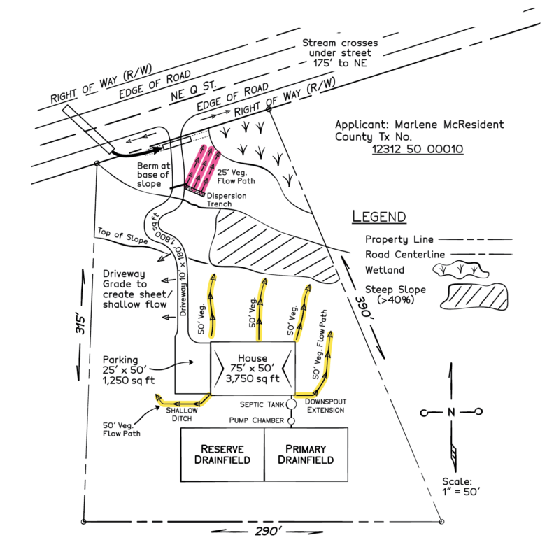
What goes on your map?
A site drainage map should include the following.
- Scale at which site plan is drawn (for example 1″ = 20′)
- North arrow so you can orient the map
- Names and location of adjacent roads
- Adjacent land uses (such as forest, residential lawn, pasture, etc.)
- Property lines and dimensions
- Buried utility lines (phone, electric, water, sewer, cable, etc.)
- Slopes, bluffs, streams, wetland areas, ponds, or waterfront, if present
- Existing structures and their dimensions, such as your house, garage, or shop
- Driveways, garden areas, patios, and decks
- Septic tank, drain field, and well, if present
- Large trees, areas of native or naturalized vegetation
- Building and property line setback distances
- Existing drainage pathways
Materials needed:
- 100′ measuring tape
- Clipboard
- Ruler
- Pencil and eraser
- Graph paper
See the fact sheet: Understanding Your Site Conditions (PDF) for more information.
Watch the video How to Make a Site Map of Your Property